Unlocking the Full Potential of Remote Sensing in Mine Waste Monitoring
Remote sensing has long been a cornerstone of geological mapping and environmental monitoring. But in mining, its full potential is only now being realised. Multiscale Observation Services for Mining-related Deposits (MOSMIN) is an EU-funded research project that is pushing this boundary by placing Earth Observation at the centre of an integrated monitoring system, combining satellite, UAV, and ground-based data to deliver a continuous, high-resolution view of mine waste deposits and their surrounding environments.
Why Remote Sensing Matters More Than Ever
Mining waste facilities are dynamic, complex systems that evolve over time. Surface conditions change rapidly, and early signs of environmental and geotechnical risk are often subtle and spatially distributed. Remote sensing offers several advantages: large-scale coverage of often inaccessible mine site areas, long temporal archives that support retrospective analysis of change trajectories, and spatially continuous observations that overcome the limitations of discrete field sampling points. MOSMIN builds on this foundation to turn EO data into operational tools for the mining sector.
The MOSMIN Approach
Mapping from Space
MOSMIN spectrally characterises surface composition across entire sites, from contamination signatures and vegetation stress to mineral assemblages relevant for resource valorisation.
-
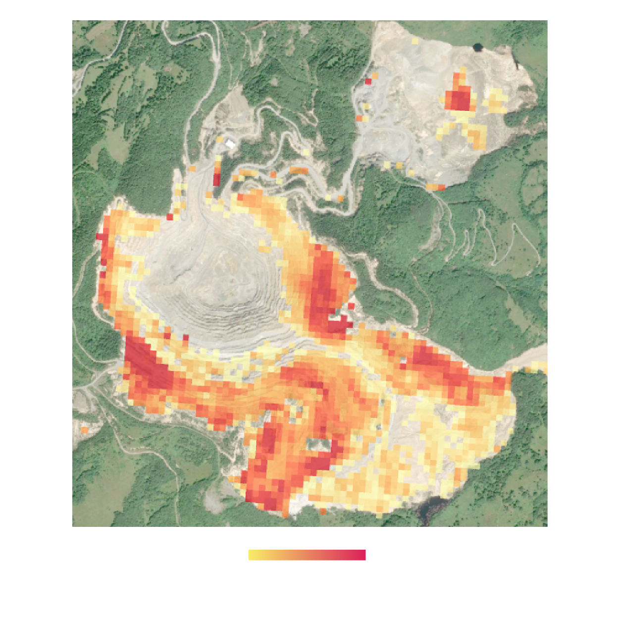
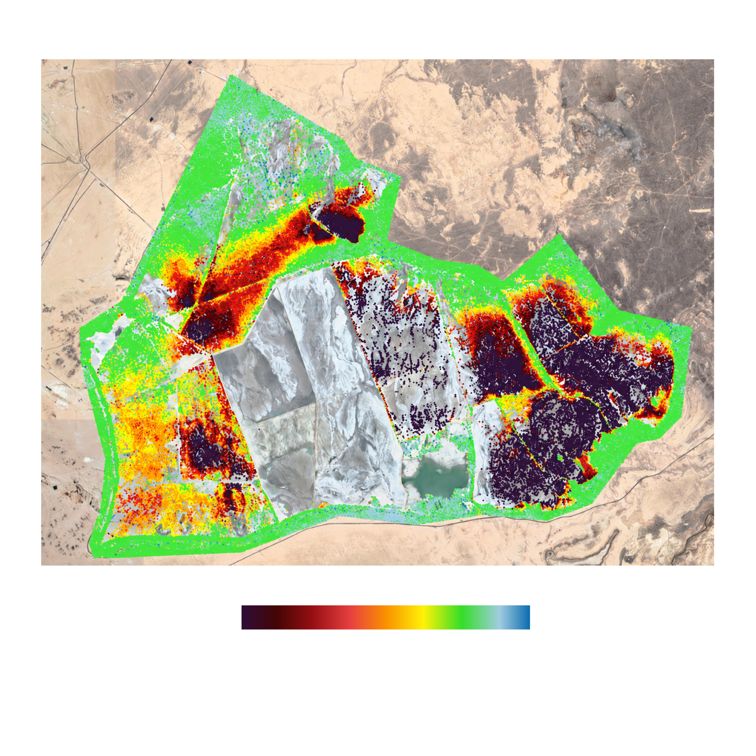
This figure shows a satellite view of a mining site with a colour-coded overlay showing the spatial distribution of Acid Mine Drainage (AMD) risk. Areas of higher risk are shown in red, while lower-risk areas are shown in yellow.
Tracking Change Through Time
MOSMIN leverages multi-temporal satellite observations to track the evolution of mine sites, detecting progressive changes such as vegetation recovery, surface displacement or chemical alteration, and translating these into automated change detection products.
By combining dense EO time series with AI-based analysis, the project enables systematic, high-frequency monitoring of site dynamics.
-
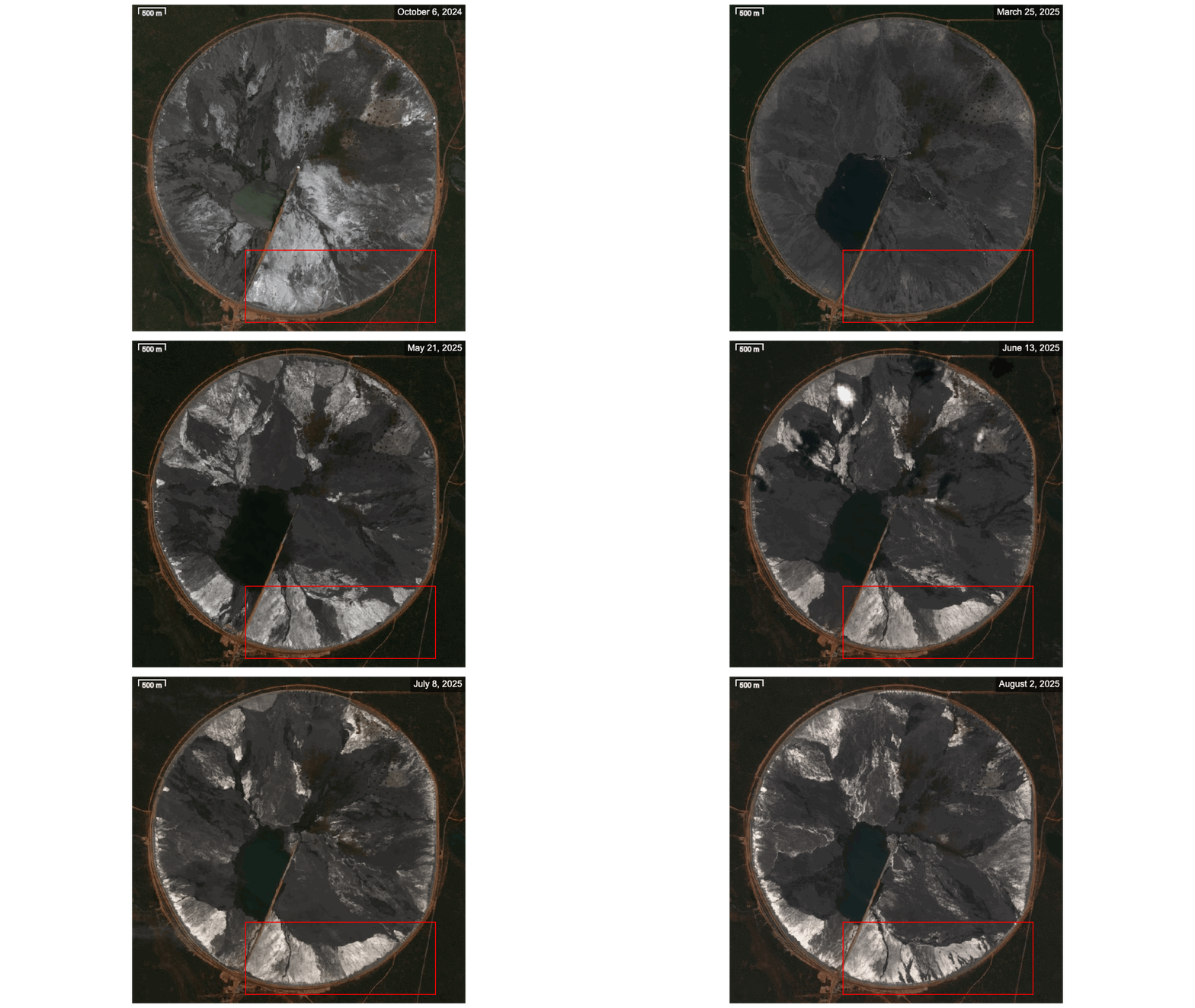
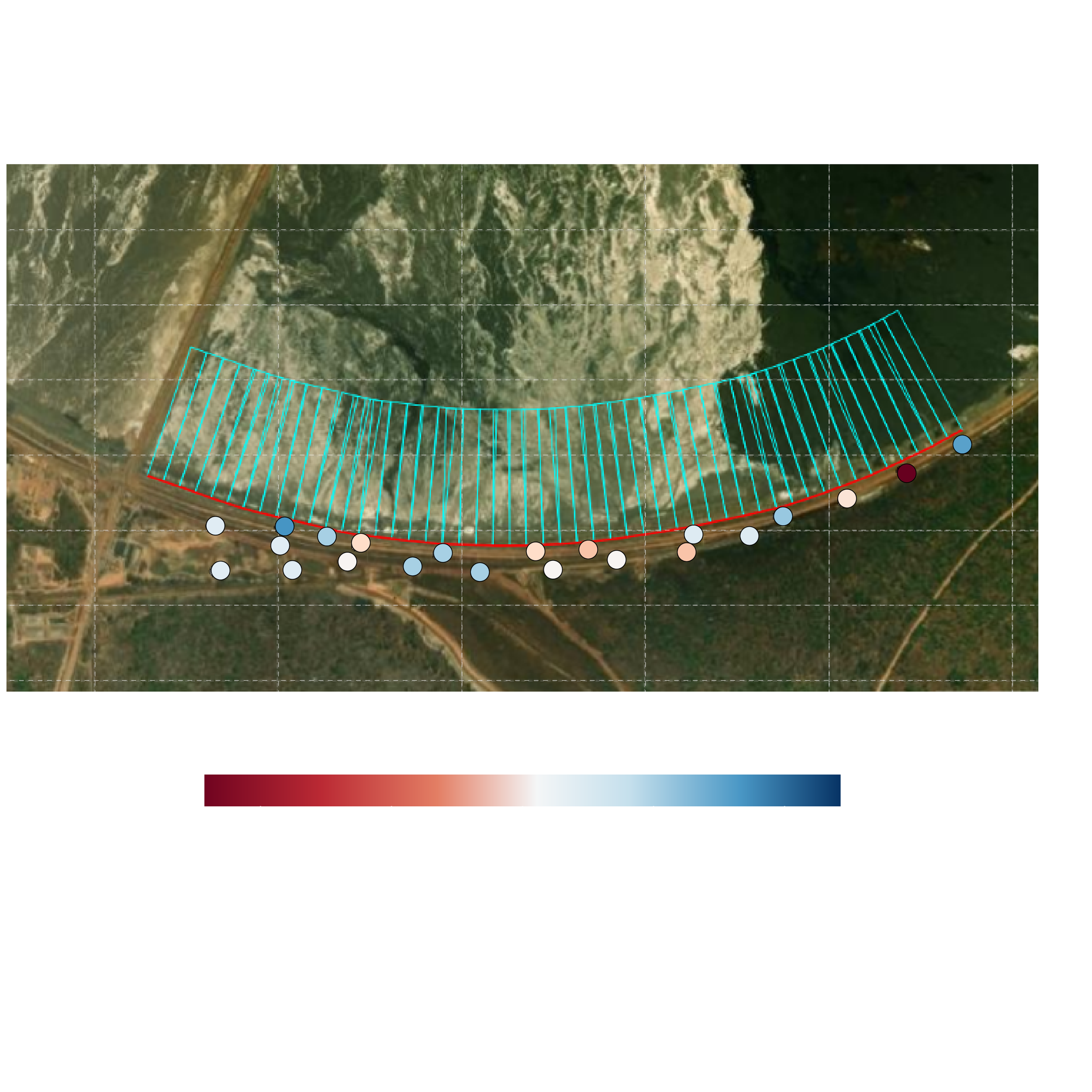
The animation presents a time series of satellite images of a tailings storage facility. The red box highlights a section of the dam shown in greater detail in the second figure, which combines satellite InSAR deformation monitoring (displayed as coloured dots), distributed fibre-optic acoustic sensing (DAS) measurements (shown as the red line), and Earth observation data collected along the same section (indicated by the blue boxes).
Measuring Ground Movement
Using Interferometric Synthetic Aperture Radar (InSAR), MOSMIN tracks millimetre-scale ground deformation across mining areas. This is critical for monitoring subsidence, detecting slope instability, and assessing tailings dam integrity. To improve measurement reliability in challenging mining environments, the project employs a new interferometric approach that reduces phase unwrapping errors and increases measurement point density, yielding a more complete and robust deformation time series.
-
This figure shows an InSAR map of accumulated ground deformation across a tailings storage facility, derived from Persistent Scatterer Interferometry (PSI) over a one-year period. The map highlights spatial variations in surface movement, revealing distinct zones of deformation across the facility.
Bridging Scales with UAV Remote Sensing
UAV campaigns bridge the scale between ground-based measurements and satellite observations: hyperspectral imaging maps mineral composition and redox conditions at sub-metre resolution, while LiDAR captures terrain and vegetation structure. These datasets resolve site-scale processes that fall below satellite detection limits and provide a reference for validating satellite-derived products.
-
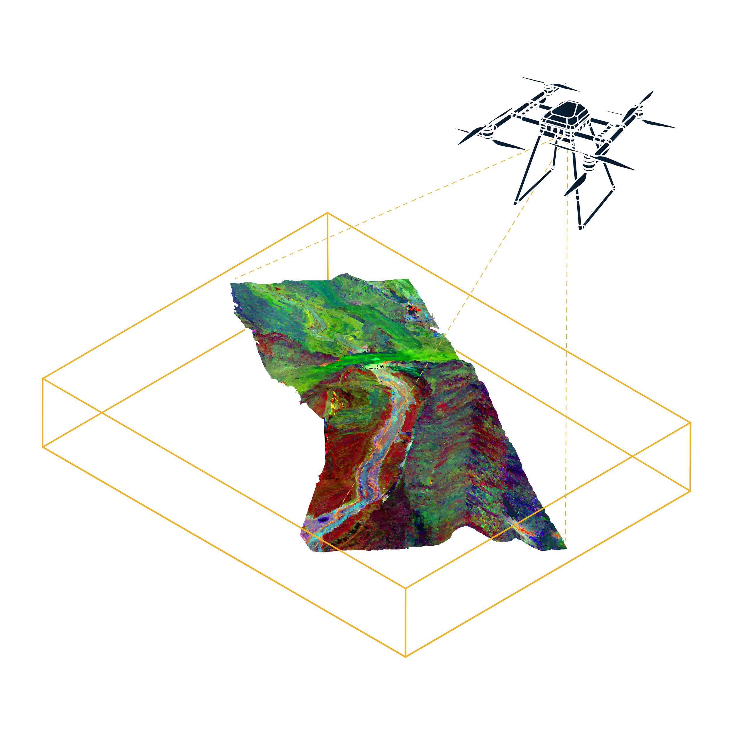
This figure shows an integrated 3D representation combining hyperspectral and geometric data over an AMD-affected runoff stream. The integration enables the spatial mapping of mineralogy and helps identify areas of potential interest for further investigation.
From Observation to Insight
The strength of MOSMIN lies in the integration of complementary data streams. For example, combining surface deformation measurements from Sentinel-1 InSAR with subsurface information from fibre-optic passive seismic monitoring provides a more complete assessment of tailings dam stability than either source alone. This integrated approach supports more informed decision-making by mine operators, consultants, and regulatory authorities responsible for managing mine waste facilities.
Impact for Mining and Beyond
MOSMIN demonstrates that integrating Earth Observation across scales, from satellite to UAV to ground-based sensors, can shift mine waste monitoring from periodic, fragmented site inspections toward continuous, spatially comprehensive diagnostics. Through the development of four services — GeoShift for ground stability monitoring, ContamTrack for contamination tracking, EnviroWatch for environmental rehabilitation monitoring and Valor3D for resource valorisation — the project translates these capabilities into practical solutions that contribute to proactive environmental oversight, improved risk management and more sustainable management of mining residues and related resources across the raw materials sector. For more details, check out our services page.